The remnants of Arthur are producing a rare high-risk flash-flood outlook across parts of the Gulf Coast and Deep South, with forecasters warning of life-threatening rain, urban inundation and isolated tornadoes.
Rare high-risk flood threat
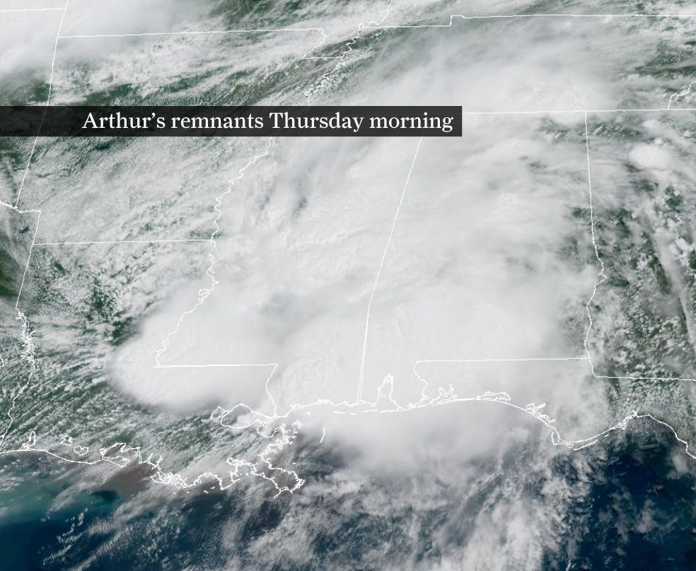
The remnants of Arthur are driving a rare high-risk flash-flood outlook across parts of the Gulf Coast and Deep South, with forecasters warning that the rain could become life-threatening in low-lying and urban areas.
The National Weather Service’s Weather Prediction Center has placed parts of southeastern Louisiana, southern Mississippi, Alabama and the western Florida Panhandle under its most severe excessive-rainfall category.
Arthur weakened into a trough of low pressure after making landfall near Matagorda Bay, Texas, with sustained winds reported at about 40 mph. Even after losing tropical-storm status, the system is still drawing deep tropical moisture inland and feeding bands of intense rainfall.
What forecasters are warning about
The forecast calls for rainfall rates of up to about 3 inches per hour in the hardest-hit areas. Localized totals could approach 20 inches, while more widespread totals are generally expected to fall in the 5-to-10-inch range.
That combination raises the risk of flash flooding, urban inundation and river flooding. In places where drainage is poor, streets can flood quickly, and repeated rounds of heavy rain can overwhelm small streams and low-water crossings.
The same setup also carries a severe-weather risk. Forecasters said isolated tornadoes are possible across parts of Alabama, Georgia and the Florida Panhandle.
How the threat developed
Reporting on June 18 first identified Arthur’s remnants as a flood concern for the Gulf Coast, then later that day broadened the warning as forecast details pointed to a rare high-risk outlook and stronger rain potential.
AP reported that Arthur was the first named storm of the 2026 Atlantic hurricane season. Other coverage said the system’s flooding threat should continue through Friday as the remnants move across the Southeast.
The high-risk designation is notable because it is reserved for the Weather Prediction Center’s most dangerous flash-flood scenarios. It signals a strong chance of major impacts if the heaviest rain sets up over vulnerable communities.
Where the risk is highest
The clearest threat runs from southeastern Louisiana through southern Mississippi and Alabama to the western Florida Panhandle, with the broader rain shield extending into parts of Texas, Georgia and the wider Southeast as the system moves inland.
Residents and emergency managers in those states face the most immediate need to monitor warnings, especially in areas prone to road flooding, rapid water rises and rescue calls.
Forecasters are also watching for localized pockets where rainfall could train over the same area for hours, increasing the chance that totals end up near the upper end of the forecast.
What to watch next
The key question now is whether the Weather Prediction Center maintains the high-risk outlook, expands it or shifts it east as Arthur’s remnants continue to drift inland.
Another important gauge is whether actual rainfall totals begin to match the highest-end projections, and whether flash-flood warnings, tornado warnings, rescues or damage reports start to mount in the hardest-hit counties and parishes.
For now, the concern is that a weakening tropical system is still capable of producing dangerous rain over a wide area, with impacts that could escalate quickly through Friday.
Revision note
Initial automated publication.