Southern Wisconsin remains at risk for more severe weather later today, according to local forecasts and the National Weather Service.
Southern Wisconsin is under another severe-weather threat later today, with local forecasters and the National Weather Service warning that strong to severe thunderstorms could return this afternoon and evening.
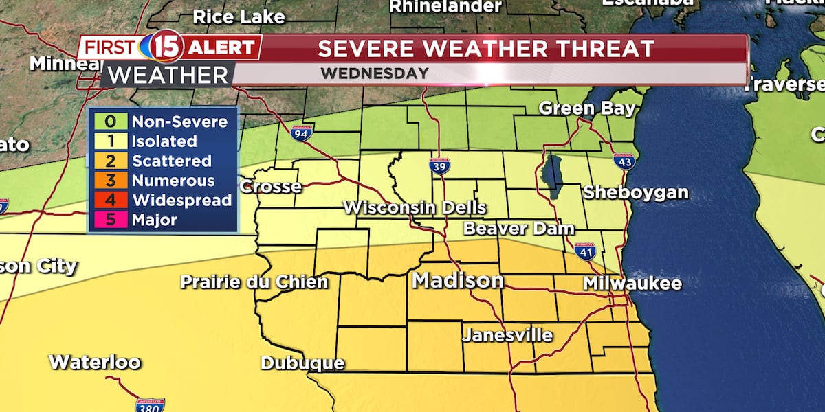
WMTV has designated the day as a First Alert Day and said additional severe storms are possible later today. The National Weather Service in Milwaukee says its hazardous weather outlook keeps the severe-weather threat on the map, and its forecast discussion continues to track storm and flooding concerns.
The NWS Quad Cities office also said additional severe storms are possible later today through the evening, with flash flooding a concern in the broader region. The main hazard in the strongest storms would be damaging wind, though hail and brief heavy downpours are also possible.
For now, the message from forecasters is to stay weather-aware through the rest of the day and be ready for alerts to change quickly if storms organize more strongly.
No tornado watch or warning had been reported in the source material available at publication time.
Revision note
Initial automated publication.