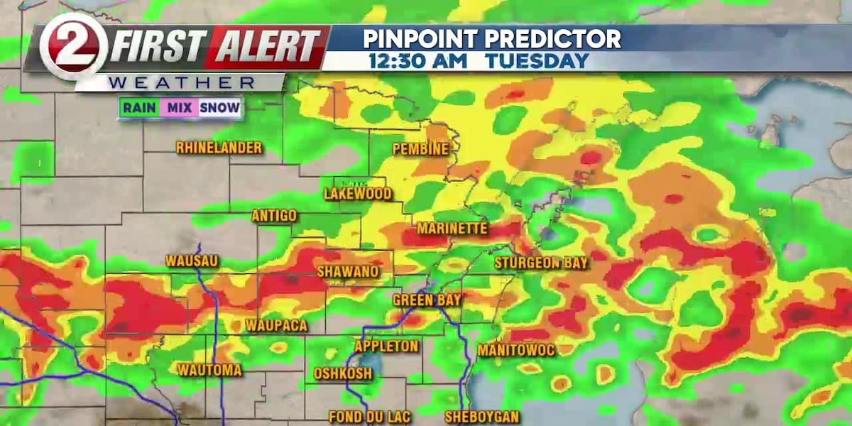
Forecasters say severe storms are expected to move into Wisconsin tonight, with risks of damaging winds, hail, isolated tornadoes and heavy rain.
Forecasters are warning that severe storms are expected to arrive in Wisconsin tonight.
WBAY says the system could bring large hail, damaging winds, isolated tornadoes and heavy rain as it moves through the region. WMTV also kept a First Alert Day in place, saying strong thunderstorms are expected later Monday.
The National Weather Service in Green Bay has issued a Flood Watch for parts of northeast Wisconsin, including Brown and Outagamie counties, from Monday afternoon through early Tuesday morning.
WEAU said the threat includes 60-plus mph winds and an isolated tornado or two. WISN added that storm chances are increasing and that stronger storms could continue into Tuesday.
The exact track of the strongest storms could still shift, but the main window for the severe weather threat is tonight into early Tuesday.
Revision note
Initial automated publication.