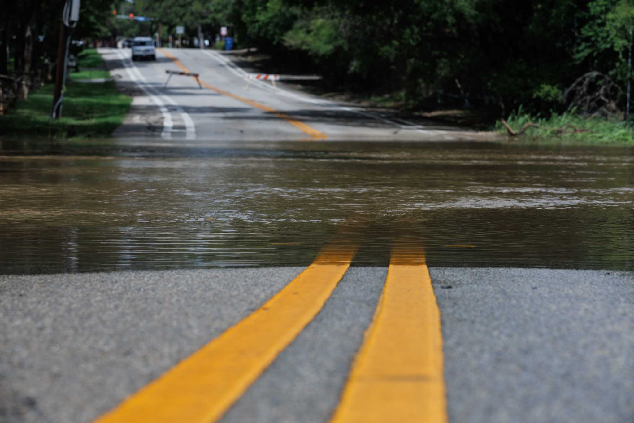
Heavy rain and flooding closed about 40 roads across Bexar County on Monday morning, June 15, 2026, as the National Weather Service kept a flash flood warning in effect for the San Antonio area. The closures were concentrated on low-lying streets, creek crossings and underpasses, and officials urged drivers to avoid flooded roadways.
Heavy rain and flooding closed about 40 roads across Bexar County on Monday morning, June 15, as the National Weather Service kept a flash flood warning in effect for the San Antonio area.
The closures were concentrated on low-lying streets, creek-adjacent routes and underpasses, where fast-rising water made travel dangerous. Local reporting said the storm had already produced several inches of rain in parts of the region, with more rain still possible later in the day.
Officials urged drivers to avoid flooded roadways and not to assume a crossing was safe just because barricades were not visible. Emergency and transportation agencies were dealing with a fast-moving weather event that was disrupting commuter traffic across the metro area.
Roads affected across Bexar County
Local reports described the disruption as widespread, with closures scattered across Bexar County rather than limited to a single neighborhood. Among the roads specifically reported closed were Beverly Hills Drive at Culebra Creek, Jones Maltsberger Road at Olmos Creek and Blue Wing Road near Interstate 37.
The closures were most severe in places where drainage channels, creeks and low-water crossings can rise quickly during intense rainfall. That left drivers facing detours, blocked intersections and delays on routes used for both local trips and through traffic.
The scale of the shutdown also raised concerns about access for emergency responders, school and work commutes, and other essential travel during the morning rush.
Storm timing and rainfall
The flash flood warning covered the San Antonio area during the morning storm band, with local coverage giving the warning end time as either 9:30 a.m. or 10:45 a.m. for different parts of the region. That difference appears to reflect separate warning polygons rather than a direct contradiction.
Reports said some parts of the area received 4 to 7 inches of rain. Express-News also reported that San Antonio set a rainfall record early Monday, underscoring how intense the burst of rain had been.
The broader storm system was still expected to bring more rain later in the day, which left open the possibility of additional ponding, renewed street closures and more flooding if new cells developed over already saturated ground.
Added impacts beyond road closures
One report said a high-water rescue temporarily closed westbound Loop 410 at Jackson Keller Road before the lanes reopened later that morning. The reopening eased one major traffic pinch point, but it also showed how quickly a local rescue can interrupt travel during a flooding event.
Another report said more than 10,000 CPS Energy customers briefly lost power during the storm. The outages were concentrated on the North, Northwest and West sides of San Antonio, adding another layer of disruption for residents already dealing with heavy rain and blocked roads.
Agencies and public safety guidance
The National Weather Service, Bexar County road and emergency officials, San Antonio Public Works and the San Antonio Fire Department were all part of the response environment around the flooding. Their role was not just to clear roads, but to warn drivers away from dangerous crossings while conditions remained unstable.
Officials have repeatedly warned during similar events that low-water crossings can become deadly even when water is not obviously deep. The guidance Monday was the same: stay off flooded roads, do not drive around barricades and wait for official updates before trying to use routes that have been closed.
What to watch next
The immediate questions were how many closures remained in place later in the day, whether any additional rescues or injuries were reported and whether the National Weather Service extended or updated the warning as the storm system moved through South-Central Texas.
As water recedes, road reopening notices are likely to follow in stages rather than all at once. Residents and commuters were being told to keep checking for updated closure lists from Bexar County and San Antonio agencies, especially in flood-prone areas near creeks and drainage corridors.
The event is a reminder that a flash flood warning can quickly become a transportation problem as well as a public safety one. In San Antonio on Monday, the rain was not just weather; it was a citywide traffic disruption with immediate safety consequences.
Revision note
Initial automated publication.