A flash flood warning covered much of Bexar County Monday morning as heavy rain triggered dangerous street flooding, road closures and a new June 15 rainfall record at San Antonio International Airport.
A flash flood warning covered much of Bexar County and central San Antonio Monday morning, with the National Weather Service warning that travel was not advised in the affected area after heavy rain caused dangerous street flooding and road closures.
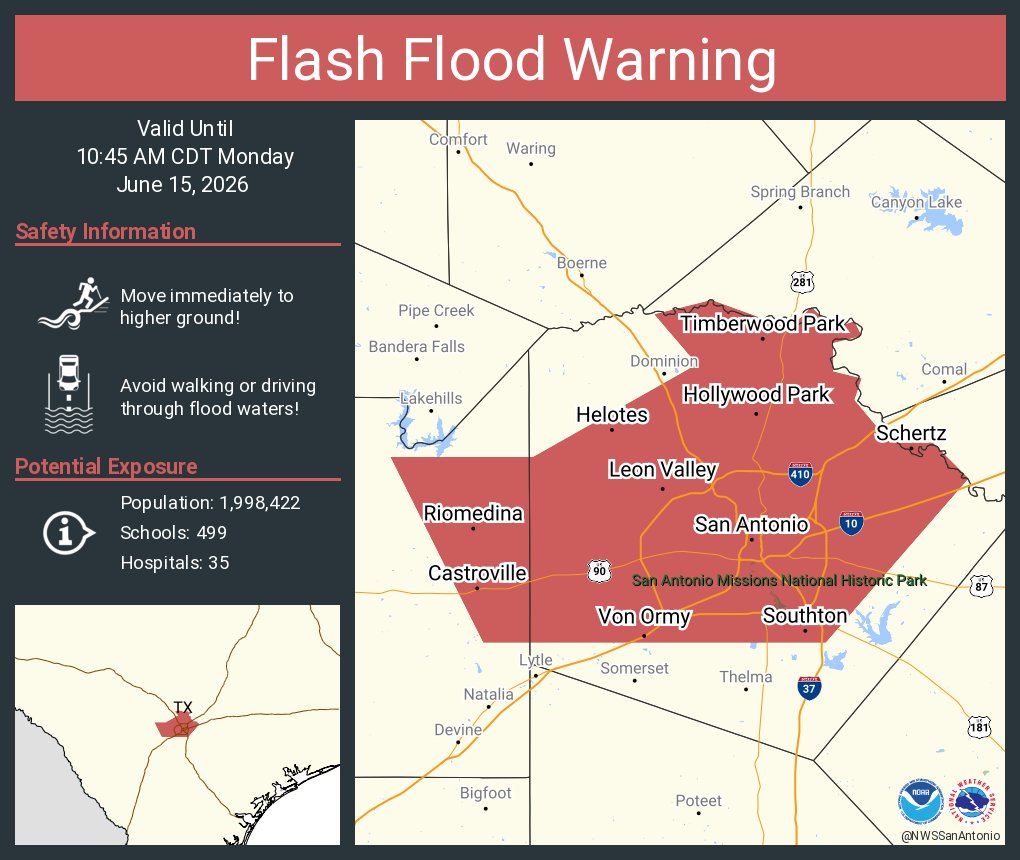
The warning, issued June 15, was set to remain in effect until 10:45 a.m. It covered downtown San Antonio and nearby communities including Alamo Heights, Castle Hills, Hollywood Park, Leon Valley, Helotes, Live Oak, Schertz, China Grove and the South Side.
Local coverage reported about 30 road closures across Bexar County, especially on the North Side, as water pooled in streets and underpasses. The National Weather Service warned of potentially life-threatening flooding in creeks and streams, urban areas, highways, streets and underpasses.
San Antonio International Airport recorded 2.35 inches of rain, which Express-News reported was a new June 15 daily rainfall record, breaking the 1.68 inches recorded on June 15, 1894.
Morning timeline
By about 7 a.m., the heaviest rain had shifted south and east of San Antonio, but moderate to heavy rainfall was still possible through roughly 9 a.m. That left the morning commute vulnerable to sudden flooding even after the peak of the storm moved away from the city center.
The flash flood warning sat inside a broader flood watch that remained in effect for the region through 7 p.m. Tuesday. Nearby cities including Boerne, New Braunfels, San Marcos and Austin were also under flash flood warnings or watches as the same slow-moving system continued across South and Central Texas.
Ongoing risk
Forecasters had already been tracking a rare June cold front and tropical moisture that were expected to drive repeated rounds of heavy rain across the region. The setup raised the risk of rapid inundation in flood-prone neighborhoods and low-water crossings, with commuters facing dangerous travel conditions and additional closures possible later Monday.
Officials were still watching whether the warning would be extended or expanded, whether more road closures would follow and whether rainfall totals would rise enough to revise the record further.
Revision note
Initial automated publication.