A flash flood warning remains in effect for much of Bexar County and the San Antonio metro area until 6 a.m. Saturday after a nearly stationary thunderstorm brought heavy overnight rain and emergency phone alerts.
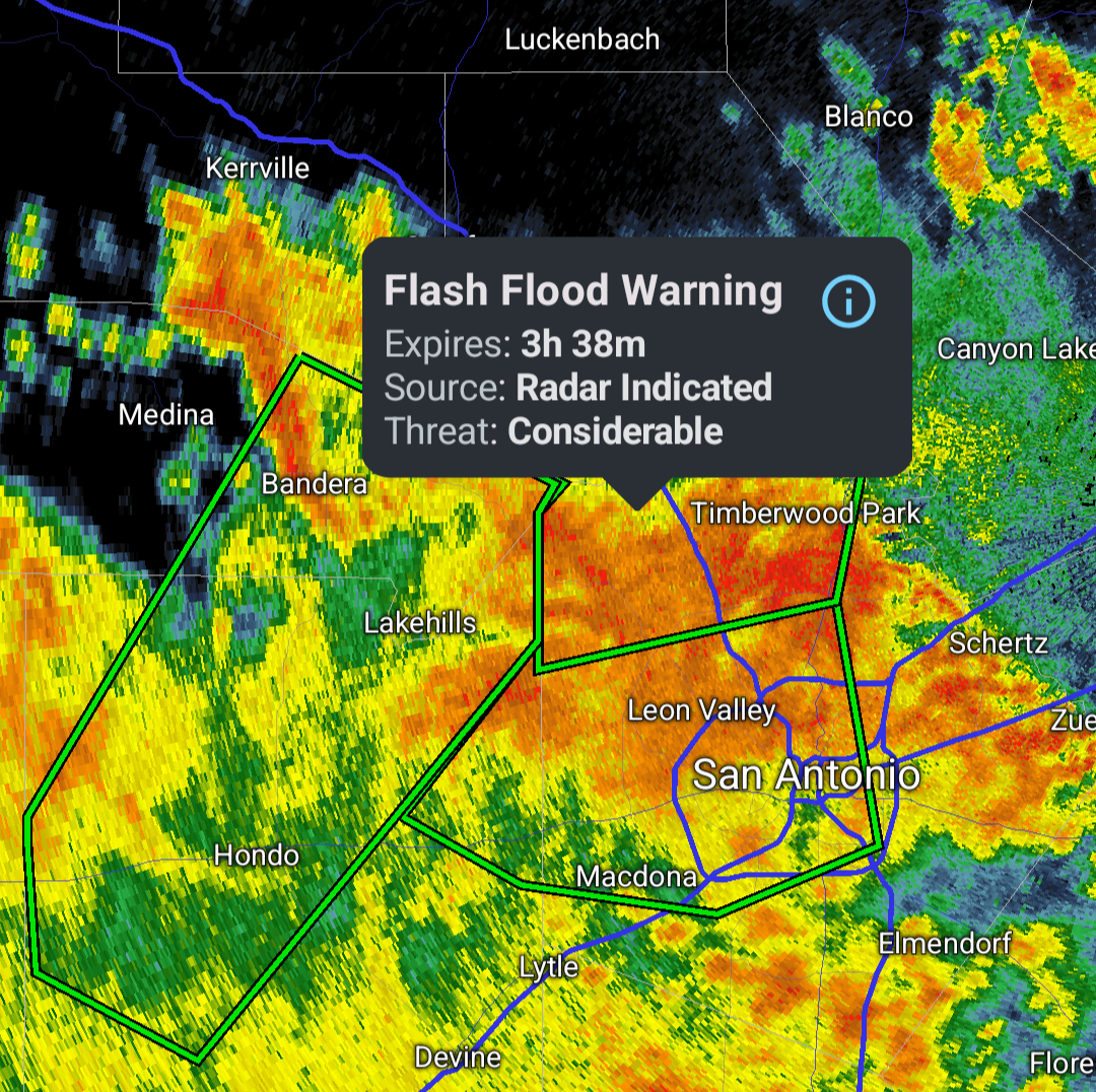
The National Weather Service issued a flash flood warning early Saturday for much of Bexar County, including a large part of the San Antonio metro area, after a nearly stationary thunderstorm dropped heavy rain overnight.
The warning was in effect until 6 a.m. Saturday, June 20, 2026. At about 2:15 a.m., the storm was over Bexar County and producing rainfall rates of 2 to 5 inches per hour, according to the weather service.
An emergency alert was sent to cellphones in the affected area warning that the situation was dangerous and life-threatening. The alert urged people not to travel unless they were fleeing floodwaters or under an evacuation order.
Where flooding was expected
The warning said flash flooding could develop within minutes in creeks, streams and low-lying urban areas. Roads, highways, streets and underpasses were also at risk.
Coverage identified several affected locations, including downtown San Antonio, Alamo Heights, Castle Hills, Leon Valley, Hollywood Park, Shavano Park, Timberwood Park, Scenic Oaks, Helotes, Castroville and the area near Lackland Air Force Base.
What forecasters expected next
Heavy rain was expected to taper after about 3 a.m., though light to moderate rain could continue through around 5 a.m. The National Weather Service warning remained the main public-safety alert as officials monitored whether it would be extended, canceled or accompanied by reports of road closures, rescues or flood damage.
San Antonio is especially vulnerable to flash flooding in low-water crossings and urban drainage corridors, making overnight warnings like this a recurring hazard for drivers and nearby neighborhoods.
Revision note
Initial automated publication.