Heavy rain triggered flash flooding across San Antonio on Monday morning, closing dozens of roads, delaying Harlandale ISD summer school and prompting repeated warnings to avoid low-water crossings.
Heavy rain and flash flooding closed multiple roads across San Antonio on Monday morning, creating commute trouble, delaying summer school start times and adding pressure to storm response crews as conditions remained fluid.
A National Weather Service flash flood warning was in effect for the San Antonio area until 10:45 a.m. Monday, June 15. Local reporting said the warning came as storms dumped heavy rain across the city and Bexar County, with flooding quickly spreading into low-lying streets and crossings.
Express-News reported about 30 roads were already closed, mostly on the North Side. The closures were part of a fast-moving morning disruption that affected drivers across the metro area as the flood risk climbed.
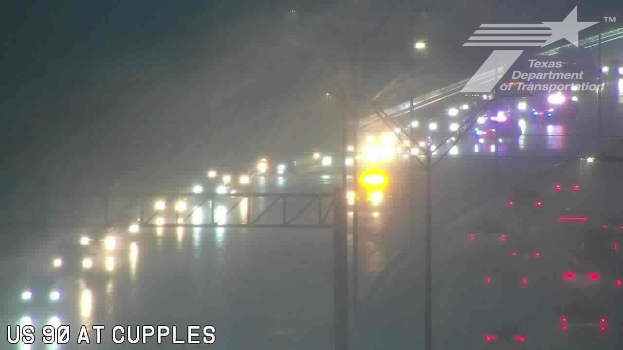
Highway 90 at Cupples Road was among the affected locations, with multiple westbound lanes closed because of flooding. San Antonio Public Works warned motorists to turn around at flashing signals at low-water crossings even if no barricade is present, underscoring how quickly conditions can turn dangerous.
Morning impact
The flooding hit during the morning commute, when roads were already busy and travel delays could ripple through the rest of the day. BexarFlood.org was being used to track real-time low-water crossing and closure updates as crews and residents watched the situation change.
The broader region remained under a Flood Watch for South-Central Texas through Tuesday evening. That left open the possibility of additional rainfall, more street flooding and more closures if storms continued to shift across the area.
Schools and utilities
The storm also affected school operations. Harlandale Independent School District delayed the start of all summer school programs to 9 a.m. because of the weather and hazardous road conditions.
CPS Energy also reported storm-related outages. The utility said flooding could slow restoration efforts, adding another layer of disruption for residents already dealing with blocked streets and slower travel.
Rainfall and context
San Antonio International Airport recorded 2.43 inches of rain early Monday, a total reported as a June 15 rainfall record. That amount of rainfall was enough to trigger widespread street flooding and force repeated public safety warnings from local officials.
The main concern remained life-threatening flash flooding in urban areas, underpasses and low-water crossings. Officials continued to stress that drivers should not try to cross flooded streets, even where barricades had not yet been placed.
What to watch
Conditions remained fluid Monday as rainfall shifted and crews assessed which roads could reopen. The immediate questions were how long closures would last, whether additional schools or transit operations would be affected and whether the weather service would extend or upgrade alerts later in the day.
For now, the event was centered on public safety, commuter disruption and a reminder that flash flooding can rapidly make familiar routes impassable.
Revision note
Expanded into a full initial public-service update with chronology, school and utility impacts, flood context and next steps.