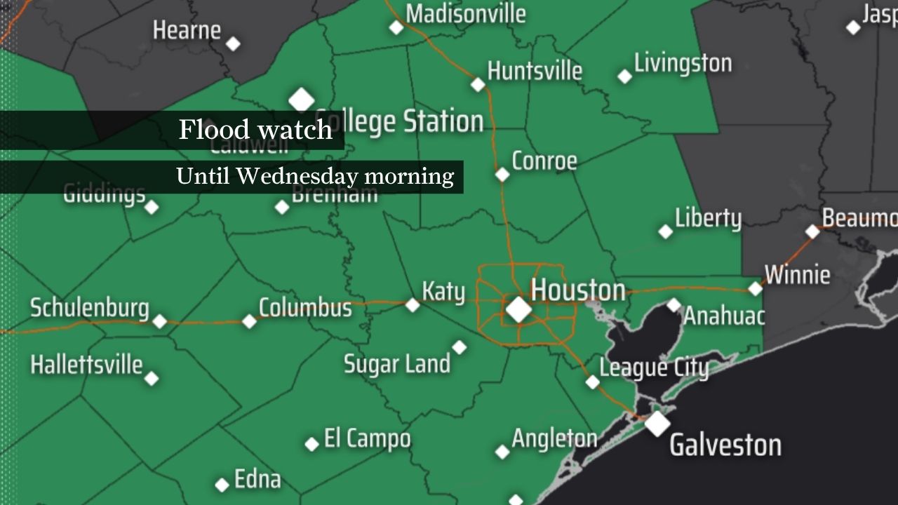
The National Weather Service has placed Houston and much of Southeast Texas under a flood watch through Wednesday morning, warning that repeated storms could bring dangerous street flooding and rapid rises on bayous and low-lying roads.
The National Weather Service has placed Houston and much of Southeast Texas under a flood watch through Wednesday morning as a slow-moving weather pattern brings repeated rounds of showers and thunderstorms.
Forecasters said the main concern is that storms could keep training over the same areas, producing dangerous street flooding and rapid rises on low-lying roads, bayous, creeks and other flood-prone areas.
The watch covers more than two dozen counties, including Harris, Fort Bend, Montgomery, Brazoria, Galveston, Chambers, Liberty, Waller, Austin, Washington, Wharton, Colorado, Grimes, Madison, Walker, San Jacinto, Polk and Trinity counties. Coastal communities from the Bolivar Peninsula to Matagorda Bay are also included.
Rainfall totals are expected to reach 2 to 4 inches across much of the area, with isolated totals of 6 to 8 inches possible where storms repeatedly move over the same locations. At peak intensity, rainfall rates could reach 2 to 4 inches per hour.
Why the flood risk is growing
Houston and Southeast Texas are being affected by a wetter pattern driven by Gulf moisture and a stalled or slow-moving weather system. Earlier forecast coverage from the Houston Chronicle warned that the region could face a rising flood threat as heavier rain bands developed through the weekend and into early next week.
The National Weather Service issued the flood watch on Sunday, June 14, as the threat became more immediate.
What residents should watch
The biggest risks are to urban streets, low-water crossings and neighborhoods with poor drainage. Flooding could also affect bayous, creeks, streams and rivers across the region if the heavier bands linger.
Officials are advising residents to monitor forecasts closely and be ready to act if flood warnings are issued. The difference between a watch and a warning matters: a watch means conditions are favorable for flooding, while a warning would indicate flooding is already happening or imminent.
What comes next
The key questions are whether the weather service upgrades any part of the area to flood warnings, and whether rainfall totals stay near the 2 to 4 inch baseline or build toward the higher isolated amounts. The next forecast updates will determine how widespread and disruptive the flooding threat becomes.
Revision note
Initial automated publication.