A flood watch now runs through 7 a.m. Thursday across much of Southeast Texas, including Houston, as repeated thunderstorms continue to train over saturated ground. Parts of the metro have already seen 3 to 5 inches of rain, and forecasters say another 2 to 4 inches is possible with isolated 6 to 8 inch totals.
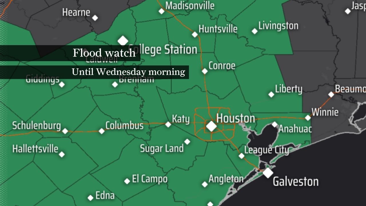
Flood watch extended
A flood watch remains in effect across much of Southeast Texas, including the Houston area, and the latest forecast now keeps it in place until 7 a.m. Thursday. That is longer than earlier guidance that had the threat easing by Wednesday morning.
Forecasters say the change reflects a longer-lived setup for repeated thunderstorms to track over the same corridor. The concern is not just how much rain falls, but how long the heavy rain bands stay anchored over already wet neighborhoods.
Rain already piling up
Radar estimates in the latest update showed 3 to 5 inches of rain already falling in parts of north and west Houston. Much of the region has been dealing with the same slow-moving storm pattern, which can quickly turn a day of heavy showers into a flooding event.
The heaviest rainfall rates in the strongest storms could reach 2 to 4 inches per hour, with isolated bursts near 5 inches per hour. That kind of intensity can overwhelm drainage systems even before a storm system fully moves through.
What could come next
Most areas could still pick up another 2 to 4 inches of rain through Wednesday morning, according to the latest forecast package. In the places where storms repeatedly train over the same area, isolated totals of 6 to 8 inches remain possible.
That higher-end risk is why forecasters are watching not only the metro core but also the surrounding counties that sit within the broader flood watch area. The threat extends across more than two dozen Southeast Texas counties, including Harris, Fort Bend, Montgomery, Brazoria, Galveston, Liberty and Waller.
Why the flood risk is elevated
The ground is already saturated, which means new rainfall is more likely to run off quickly into streets, bayous, creeks and streams. That raises the risk of street flooding, rapid water rises and travel disruptions across Houston and nearby communities.
The Weather Prediction Center has placed parts of Southeast Texas, especially near the Gulf Coast, in a level 3 of 4 flood risk. That is a sign that the setup is favorable for significant flooding if the heaviest rain bands line up over vulnerable areas.
What forecasters are watching
One added uncertainty is a tropical disturbance over northeastern Mexico that could drift toward the Gulf later this week and add more moisture to the region. Forecasters are not treating tropical development as the main concern right now, but they say it could reinforce the rain threat if it shifts closer to the coast.
The immediate questions are straightforward: where the heaviest rain bands set up, whether the watch gets extended again, and if forecasters need to upgrade parts of the area to warnings. Another key measure will be the final verified rainfall totals in the hardest-hit parts of Houston and the surrounding counties.
Timeline of the event
Earlier reporting on Sunday described a flood watch through Wednesday morning with 2 to 4 inches of rain forecast and isolated totals of 6 to 8 inches.
By Monday afternoon, the forecast had shifted and much of Southeast Texas was under a flood watch until 7 a.m. Thursday.
A later update said the Gulf disturbance could help maintain the flood threat later in the week by adding moisture to the same already wet pattern.
Houston-area residents and commuters are likely to keep dealing with a stop-and-start flood threat through midweek, with the highest danger during the heaviest repeated downpours.
Revision note
Expanded the article with updated timing, rainfall chronology, county-level context, flood risk background, and forward-looking forecast details.