Eastern upstate New York faces a heat advisory Thursday into Friday, with temperatures near 90 and heat index values in the mid-90s. Forecasters also warn of scattered thunderstorms Thursday afternoon and evening that could produce damaging wind, hail, flooding and isolated tornadoes.
Eastern upstate New York is heading into a hot, unsettled stretch that could create two different public-safety risks at once: heat stress and scattered severe thunderstorms.
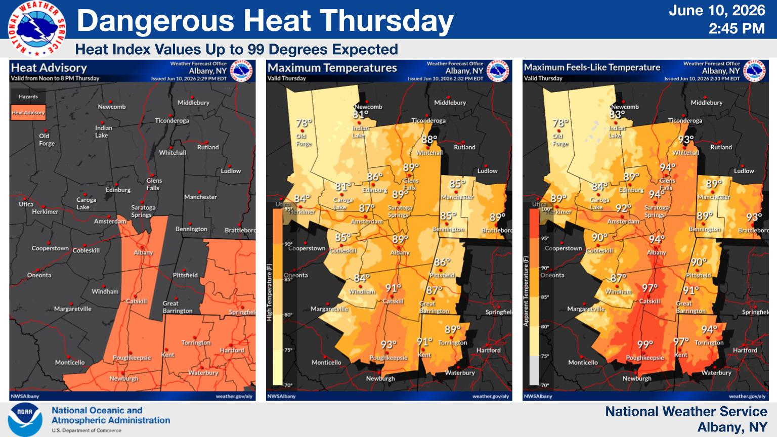
The National Weather Service has issued a heat advisory for parts of the Capital Region and Hudson Valley, including areas around Albany, from noon Thursday, June 11, through 8 p.m. Friday, June 12. Temperatures are expected to approach 90 degrees, with humidity making it feel like the mid-90s.
At the same time, forecasters say Thursday could bring scattered thunderstorms that may turn severe in places. The hazards named in the forecast include damaging wind gusts, large hail, heavy rain that could lead to flooding and the possibility of a tornado.
Heat builds first
Conditions are expected to worsen during Thursday and continue into Friday before easing over the weekend.
Outlying parts of the region, including the Mohawk Valley, Catskills and southern Adirondacks, are expected to see highs in the upper 80s. By the weekend, temperatures are forecast to settle back into the mid-80s.
The combination of high heat and humidity raises the risk of heat illness, especially for people spending long periods outdoors.
Storm threat later Thursday
The thunderstorm risk is centered on Thursday afternoon and evening, with the potential for continued activity overnight. Forecasters say the exact placement and intensity of the strongest storms will depend on how development evolves through the day.
That uncertainty has not stopped some local plans from changing already. Albany's Alive at Five concert featuring We The Kings was moved to the Corning Preserve Boat Launch because of a forecast 50 percent chance of thunderstorms Thursday.
What to watch
The main updates to monitor through Thursday are whether the National Weather Service expands or extends the heat advisory, whether any thunderstorm watch is issued for the corridor from the Capital Region into the Hudson Valley and whether storms produce reports of damage, hail, flooding or outages.
For now, the message from forecasters is straightforward: prepare for oppressive heat during the day and be ready for potentially dangerous storms later.
Revision note
Initial automated publication.