A severe thunderstorm that moved through Plainview on Thursday night produced reported gusts up to 85 mph after the National Weather Service issued an alert warning of destructive winds over 80 mph. Forecasters said more storms, hail and strong winds remained possible across the region.
A severe thunderstorm that moved through Plainview on Thursday night brought reported wind gusts up to 85 mph after the National Weather Service in Lubbock issued a severe thunderstorm alert for destructive winds.
The warning was issued around 9:40 p.m. on June 25 and expired at 10:30 p.m. The alert said winds over 80 mph were possible and urged residents to take shelter and watch for flying debris.
According to the local report, Plainview received 0.25 inches of rain during the storm. Nearby Slaton reported even stronger gusts, reaching 109 mph during the same weather event.
Storm timeline
NWS Lubbock meteorologist Cece Robinson said the warning was triggered because winds above 80 mph were forecast for the area. Robinson said the region still had more thunderstorm chances from Friday through Tuesday.
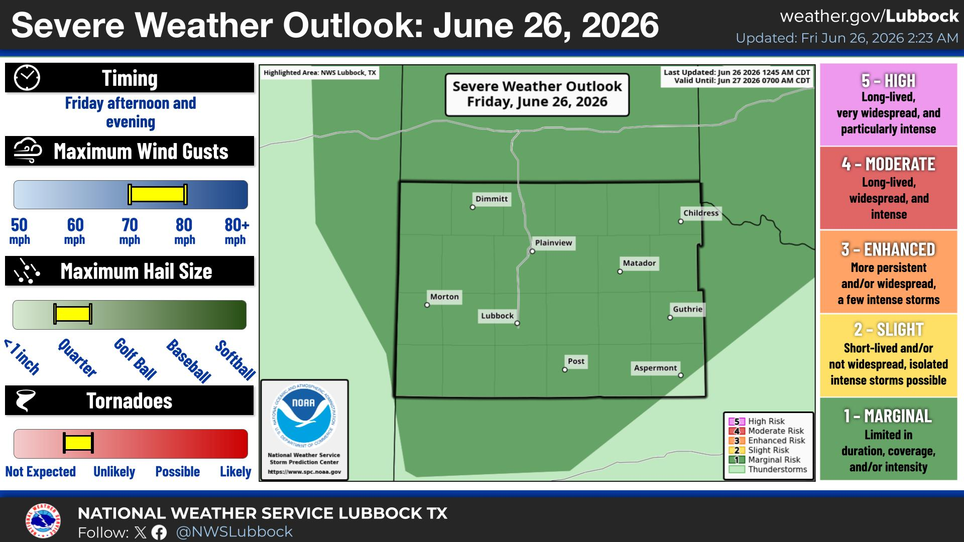
The National Weather Service outlook also included the possibility of quarter-size hail and wind gusts up to 80 mph. Forecast highs were expected to stay near 100 degrees over the weekend before easing slightly early next week.
What comes next
Forecasters said the Texas Panhandle and South Plains remained in a stretch of active weather, with heat and moisture helping keep storm chances alive. That means additional warnings could follow if new storms develop across the region.
Revision note
Initial automated publication.