San Antonio is under a Friday heat advisory while forecasters also warn of late-day storms that could trigger localized flash flooding into Saturday.
Heat and flood threats overlap
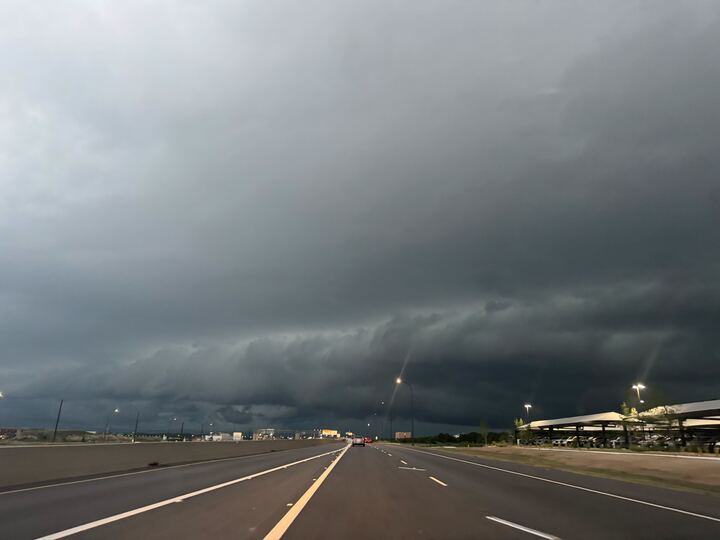
San Antonio is dealing with two weather hazards at once: dangerous heat during the day Friday and a growing risk of flash flooding later as storms develop across South-Central Texas.
The National Weather Service issued a Heat Advisory for Friday, June 19, from noon to 8 p.m. for parts of South-Central Texas, including the Coastal Prairies, the I-35 Corridor and the Rio Grande Plains. Forecasters said heat index values could reach 108 to 112 degrees in the advisory area.
For San Antonio specifically, the forecast called for about a 40% chance of showers and thunderstorms after 1 p.m. Friday. Temperatures were expected to reach the mid-90s, with heat index values around 106 degrees.
That combination means residents could face a midday heat risk first and then a separate storm threat later in the day. The National Weather Service also said hazardous heat could continue through the weekend, with possible additional heat-related products if conditions warrant.
Flood risk rises Friday night
The same forecast cycle warned of locally heavy rain from Friday night into Saturday, with the potential for flash flooding and rises on area creeks, streams and rivers.
Forecasters said the heaviest storms could produce rainfall rates above 2 inches per hour. The excessive-rainfall outlook was described as a level 2 of 4 risk across much of South-Central Texas, with the Edwards Plateau and Hill Country among the areas mentioned early in the event before the risk expands south and east later Friday.
That setup raises the stakes for drivers, especially near low-water crossings and other flood-prone roads. Even short-lived downpours could create rapid flooding if storms repeatedly track over the same area.
What to expect into the weekend
Rain chances are expected to remain into Saturday, with temperatures easing into the upper 80s and low 90s. Storm chances are then expected to drop by Sunday, June 21, as sunnier conditions return.
The timing could complicate Juneteenth weekend plans across San Antonio and surrounding communities. Outdoor events, travel and late-afternoon activities are most likely to be affected if storms arrive on schedule or intensify after sunset.
Officials and residents will also be watching for any flash flood warnings Friday evening and Saturday, along with any updates to the heat advisory as the forecast evolves. The immediate concern is not one single hazard, but the overlap of dangerous heat and localized flooding within the same forecast period.
Revision note
Initial automated publication.