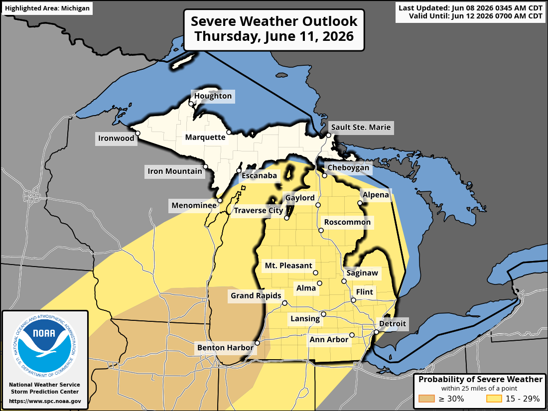
Michigan is facing two rounds of severe weather from Wednesday night into Thursday night, with watches and warnings already issued and an enhanced risk highlighted for much of the Lower Peninsula.
Michigan is heading into a two-round severe-weather period, with watches and warnings already posted in parts of the state and a stronger round expected Thursday night.
Forecasters said the first line of storms moved in Wednesday evening, while the more consequential threat was expected late Thursday and into the overnight hours. The setup has put much of the Lower Peninsula under close watch as storm timing and intensity continue to be refined.
Wednesday evening's first round
Local reporting and weather officials said the first round was expected to move west to east across parts of Lower Michigan on Wednesday evening. The main hazards were damaging wind gusts, hail and isolated tornadoes, with some local reports saying winds could reach 60 to 80 mph in the strongest storms.
A severe thunderstorm watch was issued for parts of western and eastern Lower Michigan, signaling that conditions were favorable for severe storms to develop. The watch covered areas where forecasters said storms could become dangerous quickly as they crossed the state.
As the line moved through the state, a severe thunderstorm warning was issued for Benzie and Manistee counties with radar-indicated 60 mph wind gusts. That warning underscored the immediate threat from the first round, which officials said could produce damaging straight-line winds even before the more significant Thursday setup arrived.
A tornado warning was also issued for northwestern Tuscola County and southeastern Bay County after radar indicated a thunderstorm capable of producing a tornado near Fairgrove and Akron. The warnings added urgency to an already active evening and showed that the severe-weather threat was not limited to wind and hail.
Thursday night's stronger threat
The higher-end threat was forecast for Thursday evening, with an enhanced risk covering much of the Lower Peninsula, including areas such as Big Rapids, Midland and Manistee. Local coverage said the stronger line could bring damaging winds as the main hazard, with some storms capable of producing gusts above 75 mph.
That second round was also described as carrying a greater tornado risk than the earlier system. Grand Rapids National Weather Service forecasters said additional strong to severe storms were likely late Thursday evening into the early overnight hours, a timing window that raises concern because dangerous storms arriving after dark are harder to spot and react to.
The Storm Prediction Center and local National Weather Service offices have been tracking the setup as it evolves. The forecast shifted from an early-week discussion about the possibility of severe weather into an active event with watches, warnings and county-level alerts already being issued.
What residents should watch next
Heavy rain remains part of the threat, along with the possibility of localized flooding if storms slow down or train over the same area. Heat and humidity were also cited in local reporting as ingredients that helped create a more favorable environment for stronger storms later in the week.
The next key questions are whether the June 10 storm line continues to produce severe warnings as it moves east, whether any tornado damage is confirmed, and whether the Thursday outlook is upgraded or expanded in later updates. Forecasters are also watching whether the stronger Thursday night system arrives on its current timeline or shifts earlier or later.
Residents across western, central and eastern Lower Michigan should continue to monitor warnings closely, especially as conditions change through the evening and overnight hours. The severe-weather threat is active now, and additional watches or warnings could be issued as the system develops.
Revision note
Initial automated publication with fuller severe-weather chronology and risk context.