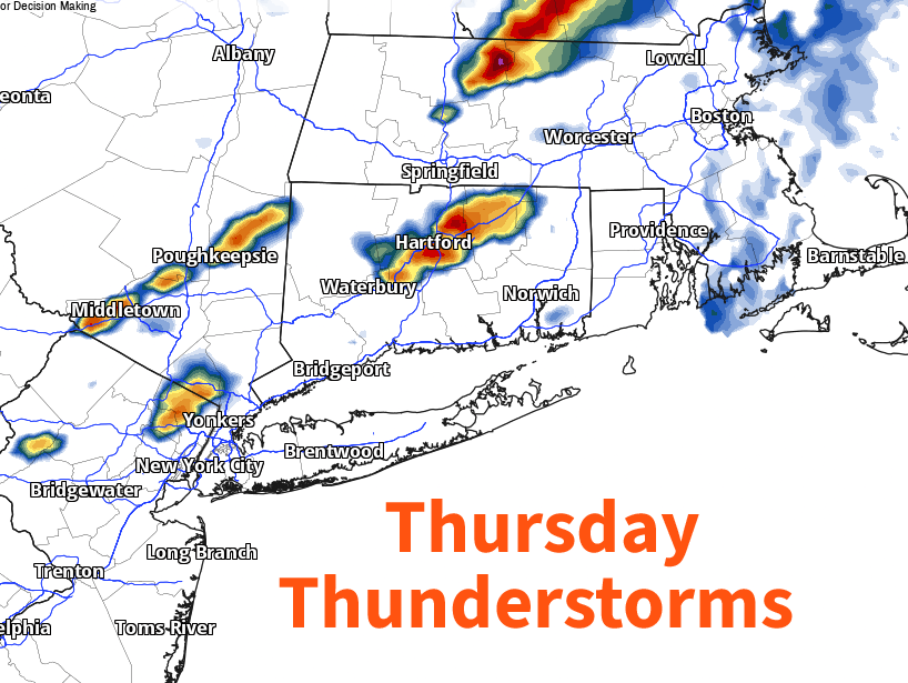
Connecticut faces scattered showers and thunderstorms Thursday, with the greatest severe-weather concern inland and a drier stretch expected by Friday into the weekend.
Scattered showers and thunderstorms are expected across Connecticut on Thursday, with the best chance for rain and stronger storms arriving from late morning through early evening.
Forecasters say the day is not expected to be a washout, but some storms could become severe, especially inland and in the Litchfield Hills. Along the shoreline, breezier conditions are possible, with south winds gusting to around 30 mph in some spots or in stronger storms.
Timing and impacts
A cold front moving through the region is helping set up the unsettled weather. CT Insider reported that morning showers and thunder are possible, but the more organized and stronger storms are more likely later Thursday.
Thursday highs are expected to range from the mid-70s along the shoreline to the low-to-mid 80s inland.
The main severe-weather concern is damaging wind gusts, which could lead to isolated tree damage or power outages if stronger storms develop. Lightning will also be a hazard for outdoor plans.
CT Insider said the National Weather Service Storm Prediction Center had placed Connecticut in a Level 2, or Slight Risk, for severe weather.
Dry conditions add context
The storm chance comes as much of Connecticut remains in elevated brush-fire risk because of ongoing drought conditions. The Connecticut Department of Energy and Environmental Protection said on June 17 that southern, northeastern and northwestern Connecticut were in moderate drought, while the rest of the state was abnormally dry.
Rain from Thursday’s storms could help dry areas, but forecasters say scattered downpours will not fully erase the state’s dryness.
Better weather follows
Conditions are expected to improve quickly after Thursday. Forecasts call for a drier, less humid stretch Friday through Sunday, with the next rain chance arriving late Sunday night into Monday, though timing remains uncertain.
Revision note
Initial automated publication.