Texoma faces another severe-weather threat today, with local and National Weather Service guidance warning of hail, wind and tornado potential.
Forecasters say strong storms could develop later today across Texoma and nearby parts of the southern Plains, with large hail and a possible spin-up tornado among the main concerns.
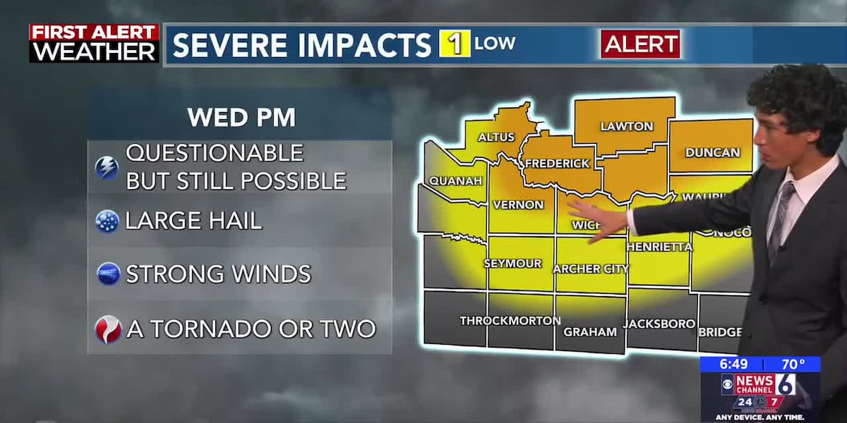
KAUZ placed the area under a First Alert Weather Day and warned that storms could redevelop later today. The station said the biggest hazards could include golf ball-sized hail and a brief tornado.
The National Weather Service in Norman says scattered severe storms are possible Wednesday afternoon into late night across much of the area. The Storm Prediction Center also says severe thunderstorms are possible across parts of the southern and central Plains, with risks including large hail, damaging winds and perhaps a few tornadoes.
The immediate question is whether storms actually form later this afternoon and, if they do, whether any reach warning criteria. For now, forecasters are telling people in the region to stay alert through the evening.
The threat remains active and could change quickly as storms approach.
Revision note
Initial automated publication.