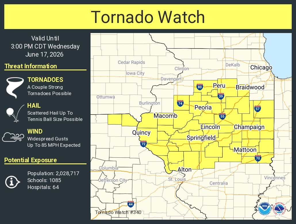
The National Weather Service issued a tornado watch for parts of central and northern Illinois and far northeast Missouri on June 17, then expanded the severe-weather threat later in the day. Live updates later reported multiple tornado warnings and confirmed tornadoes near Springfield and Salisbury as the outbreak moved east.
The National Weather Service issued a tornado watch early Tuesday for parts of central and northern Illinois and far northeast Missouri, warning that the atmosphere could support a few tornadoes, some possibly intense, along with damaging winds and large hail.
The first watch covered the region from 7:50 a.m. to 3 p.m. CDT on June 17, according to local coverage of the Storm Prediction Center forecast. Journal Courier reported the threat included wind gusts up to 85 mph and hail as large as 2.5 inches.
Morning watch
The initial watch placed much of central and northern Illinois under a heightened alert as forecasters tracked a setup favorable for severe supercell storms. The warning was not limited to one narrow corridor; it stretched across a broad area where residents were told to stay ready for rapidly changing conditions.
Local reporting tied the watch to the National Weather Service Storm Prediction Center, which said the environment could support tornadoes, damaging winds and very large hail. For people in the affected counties, that meant the day could turn from a forecast concern into a direct safety issue in a matter of hours.
Threat expands
Later in the day, the Storm Prediction Center issued a second tornado watch for central Illinois and the St. Louis area. That watch was effective from 2:15 p.m. to 10 p.m. CDT on June 17 and carried the same concern that supercell storms could produce tornadoes, damaging winds and large hail.
The second watch showed the event was not confined to the morning forecast area. As the storm system moved east, the severe-weather risk broadened to include additional parts of central Illinois and the metro St. Louis region.
Watch turns into warnings
As storms developed, live updates reported multiple tornado warnings across central Illinois, including Menard, Sangamon, Logan, Christian, Adams, Brown and Pike counties. The warnings reflected an escalation from potential severe weather to immediate danger for people in the path of the storms.
Those live reports said emergency management and law enforcement were confirming some of the activity from radar-indicated rotation and field reports. That added ground-level verification to what forecasters were seeing on radar.
Confirmed tornadoes were reported near Springfield and Salisbury as the outbreak continued east. The live coverage also reported pingpong ball-sized hail and winds up to 60 mph in parts of central Illinois.
Public safety impact
The sequence of watches and warnings required fast decisions from residents across the affected counties. Forecasters were not only warning about tornadoes, but also about the risk of destructive hail and damaging straight-line winds.
The National Weather Service offices covering central Illinois and the Storm Prediction Center were the main official forecast sources referenced in the coverage. Local emergency managers and law enforcement became important in helping confirm what was happening on the ground as the storms intensified.
By 10 p.m. CDT, live coverage said the severe-weather event was over for the region. Even after the immediate threat passed, the key follow-up questions remained the same: where tornadoes touched down, how strong they were, and what damage they caused.
Official damage surveys will be needed to determine final tornado tracks and intensity. Reports of any injuries or significant damage would also help establish the full impact of the outbreak across central Illinois.
Revision note
Expanded chronology and verified severe-weather escalation.