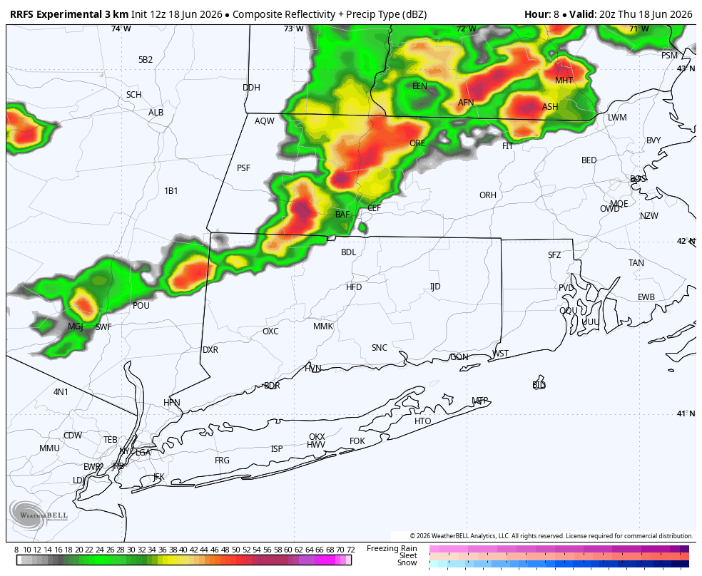
A tornado watch remained in effect Thursday for parts of upstate New York, Vermont and western Massachusetts as severe storms brought heavy rain, hail, damaging winds and flash flooding to the Capital Region.
A tornado watch remained in effect Thursday for parts of upstate New York, Vermont and western Massachusetts as a fast-moving line of severe storms pushed northeast ahead of a cold front.
The National Weather Service said the watch was set to run through 3 p.m. Thursday. Forecasters said damaging winds were the main concern, with tornadoes possible but less likely than widespread wind damage, hail and heavy rain.
Impacts already reported
Reports from the Capital Region showed the storm threat was already producing damage before the watch expired. Times Union reported flash flood warnings in Saratoga Springs, Amsterdam and Montgomery County.
The same reporting said penny-size hail fell near Waterford and Mechanicville. Wind gusts were reported up to 60 mph, bringing down trees and power lines and forcing road closures on Union Street in Niskayuna and Route 146A in Clifton Park.
Times Union also reported that a tornado warning was briefly issued for Otsego, Madison and Chenango counties.
Where the watch stretched
The watch covered parts of upstate New York, Vermont and western Massachusetts, with nearby coverage also noting severe-weather risk in northern Connecticut and adjacent areas.
CT Insider reported the Storm Prediction Center had placed Connecticut under a slight risk for severe thunderstorms, with damaging winds the primary threat and only a low risk of an isolated tornado.
That wider setup underscored that the event was not just a local thunderstorm burst. It was part of a broader severe-weather corridor moving across the Northeast.
The larger storm system
AP reported the system was tied to the remnants of Tropical Storm Arthur, which had already produced heavy rain, flooding, downed trees, structural damage and power outages in the Gulf Coast region before moving toward the Northeast.
Local coverage described the weather pattern as a damaging rain-and-wind setup rather than a classic tornado outbreak. That distinction mattered because the most likely impacts were expected to come from straight-line winds, flash flooding and scattered hail, even though brief tornado warnings were possible.
What comes next
The tornado watch was scheduled to expire at 3 p.m. Thursday unless it was extended or replaced by new warnings.
Forecasters were watching for additional severe thunderstorm or tornado warnings as the line moved east. Emergency managers and utilities could also face more reports of flooding, outages and wind damage if storms lingered or intensified.
Residents in the affected corridor were urged to stay alert through the afternoon and early evening as the storm system continued across the region.
Revision note
Expanded with verified impacts, regional context and watch timeline.