The National Hurricane Center issued its first advisory on Potential Tropical Cyclone One as the Gulf system neared the South Texas coast, prompting tropical storm watches, flash-flood concerns and coastal hazards across Texas and Louisiana.
The National Hurricane Center issued its first advisory Tuesday on Potential Tropical Cyclone One, a Gulf system near the South Texas coast that is expected to bring heavy rain, coastal flooding risks and possible tropical-storm conditions to parts of Texas and southwest Louisiana.
The advisory came as local coverage tracked the storm approaching the Texas coastline and officials warned that the system could strengthen enough to become Tropical Storm Arthur. The NHC said the disturbance had a 60% chance of becoming a tropical cyclone within 48 hours.
The storm was reported about 65 miles southwest of Corpus Christi, moving northeast at 6 mph with maximum sustained winds near 30 mph. Forecasters said the system was still organizing, but conditions in the western Gulf were favorable enough to keep the threat escalating quickly.
First advisory and forecast track
Potential Tropical Cyclone advisories are used when a system is not yet a tropical cyclone but is expected to bring tropical-storm or hurricane conditions to land within about 48 hours. In this case, that meant the NHC could begin formal warnings before the storm fully developed.
The forecast called for the system to move offshore from the Texas coast late Tuesday or early Wednesday, then track toward eastern Texas or southwest Louisiana by Wednesday night or early Thursday. That path still leaves room for changes in timing, strength and exact landfall location.
A Tropical Storm Watch was in effect from Sargent, Texas, to Morgan City, Louisiana. The watch covered a long stretch of coastline from the upper Texas coast into southwest Louisiana, signaling the possibility of tropical-storm conditions if the system strengthens on schedule.
Flooding threat
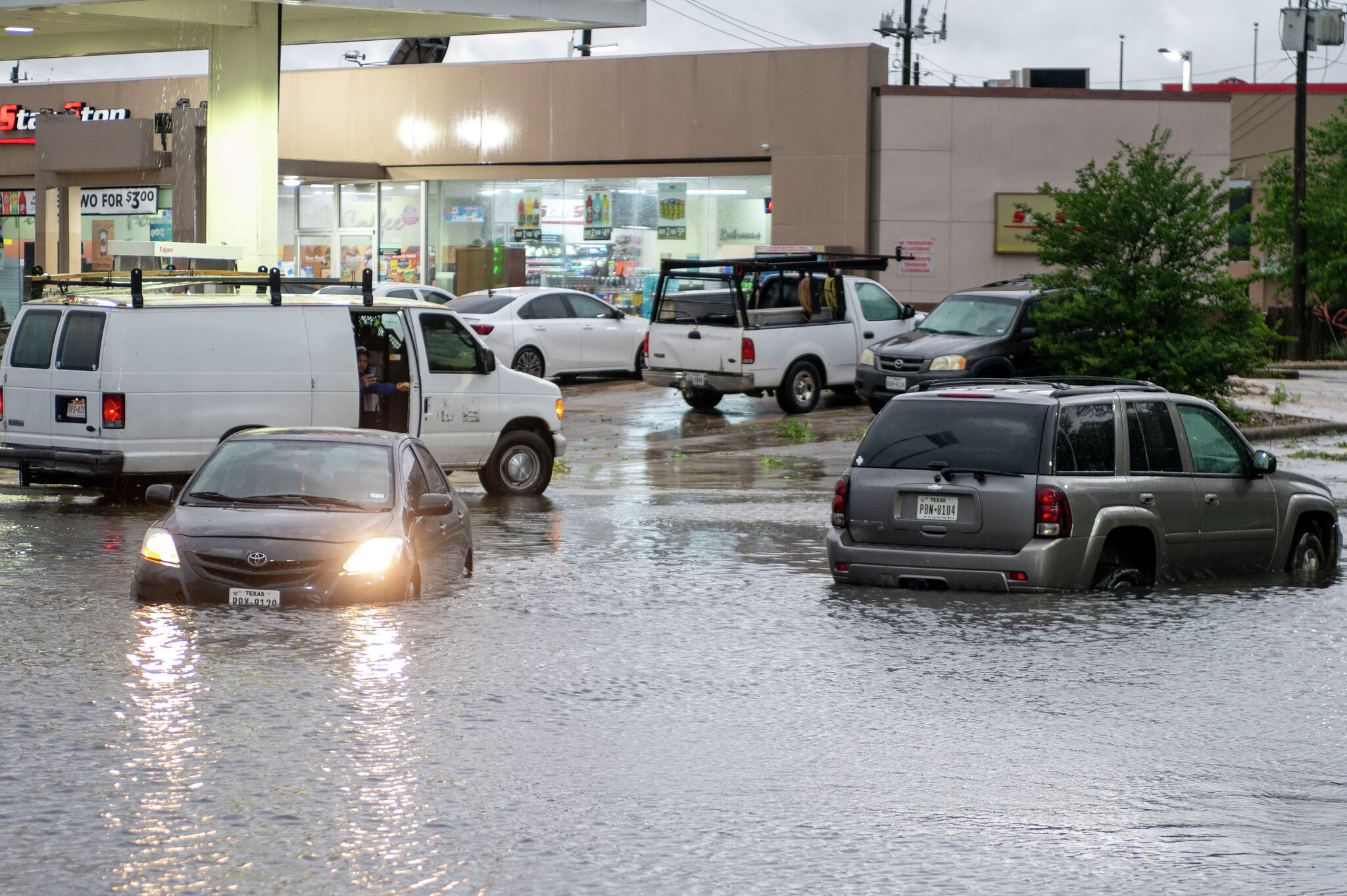
Rainfall is the main hazard. Forecasts called for 4 to 8 inches of rain across parts of Texas and the central Gulf Coast, with isolated totals of 10 to 12 inches possible.
The NHC and local coverage emphasized the risk of life-threatening flash flooding, especially in places that are already saturated or prone to rapid runoff. Even areas that do not see the center of the storm could still face dangerous water rises if the heaviest bands train over the same locations.
Houston was already seeing flood-watch concerns as the rain shield expanded inland. Local reporting said the metro area could face significant downpours even without a direct landfall, adding to the threat for roads, neighborhoods and low-lying areas.
Coastal and marine impacts
Along the coast, the watch area from Sargent to Morgan City raised concerns about coastal flooding, rough surf and marine hazards. Gusty winds were also part of the forecast, along with the possibility of a few tornadoes in the outer rain bands.
The system's exact intensity remained uncertain, but the setup was enough to trigger early preparedness across coastal Texas and Louisiana communities. Emergency managers and residents in the watch zone were being asked to prepare for changing conditions as the system moved closer.
What to watch next
The key questions are whether the disturbance reaches tropical-storm strength and receives the name Arthur, how long it stays over water before landfall and whether the center tracks farther north or south along the Gulf Coast.
Rain totals in the Houston area versus the coast will also be important, along with any upgrades from watches to warnings. The next major milestones are the storm's organization over the Gulf and any reports of flooding, tornadoes or surge as it approaches land.
Local coverage described the system as the first tropical threat of the 2026 Atlantic hurricane season, and the coming forecast cycles will determine whether it remains a tropical cyclone threat or becomes a more direct coastal impact event.
Revision note
Initial automated publication.