UC San Diego researchers say a new AI system called GOFLOW can turn existing satellite imagery into hourly, high-resolution ocean-current maps.
UC San Diego researchers say a new AI method can map ocean currents in unprecedented detail using existing weather-satellite imagery.
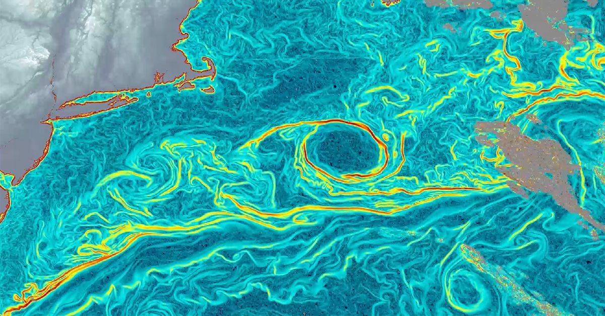
The system, called GOFLOW, uses deep learning on thermal imagery from geostationary satellites to produce hourly, high-resolution maps of ocean surface currents. The university says the approach does not require new hardware.
The study was published April 13 in Nature Geoscience. UC San Diego says the method was tested against shipboard measurements and standard satellite products.
According to the university, the new maps could help improve understanding of ocean circulation and support future forecasting and climate research. The team says the approach uses data that satellites are already collecting, which could make it easier to scale.
Researchers have not yet said how soon GOFLOW might be used in operational forecasting systems, but the paper presents it as a faster and finer-grained way to observe surface currents from space.
Revision note
Initial automated publication.