The World Meteorological Organization says El Niño could strengthen rapidly during July-September, sharpening earlier warnings and raising weather risks for monsoon-dependent and ENSO-sensitive regions.
The World Meteorological Organization is warning that El Niño may develop rapidly during July-September, sharpening an earlier June outlook that said the climate pattern was increasingly likely to return later in 2026.
The new warning matters because the timing is now more urgent. Rather than simply signaling that El Niño could emerge sometime later this year, the latest reporting points to a faster transition over the coming months, narrowing the window for governments and forecasters to prepare.
Coverage of the update says the WMO is still not locking in a single outcome for intensity. Some model signals do not point to a strong El Niño, while others do, leaving uncertainty about how powerful the event may become even as the risk of rapid development rises.
What changed from the June outlook
In early June, the WMO said El Niño had a high probability of forming before September and an even higher chance of appearing before November. That guidance framed the event as an important near-term possibility, but it still left room for variation in timing and strength.
The July reporting sharpens that picture. The latest seasonal climate update is being described as warning that El Niño could strengthen rapidly between July and September, which is a more immediate and operationally important signal for planners.
That distinction matters for weather agencies, water managers and agricultural planners. A faster onset can reduce the time available to adjust rainfall forecasts, crop plans, reservoir operations and heat-risk preparations.
Why forecasters are concerned
El Niño is the warm phase of the El Niño-Southern Oscillation, or ENSO, and it can alter weather patterns around the world. Its effects are not uniform, but the pattern is known for pushing rainfall and temperature away from normal seasonal expectations in many regions.
The WMO has said the last El Niño in 2023-24 was one of the five strongest on record and contributed to record global heat in 2024. That backdrop is one reason the agency’s latest warning is being treated seriously even though the eventual strength of the next event remains uncertain.
The current risk framing is not that severe impacts are guaranteed everywhere. It is that the probability of a disruptive climate shift is rising soon enough to affect planning now, especially in places already exposed to volatile seasonal rainfall.
Where the risks are highest
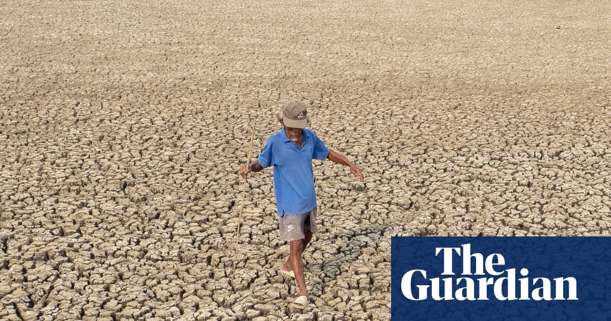
The areas being watched most closely include the Indian subcontinent and other regions sensitive to ENSO-driven rainfall changes. In those places, El Niño can disrupt the timing and distribution of monsoon rains, which in turn affects planting decisions, crop yields and water supply management.
The stakes are broad. Agricultural losses can follow from drought or from rainfall arriving in the wrong place or at the wrong time. Water managers may face tighter margins if reservoirs refill less reliably. Emergency agencies may also need to prepare for a wider spread of hazards than just dry conditions.
The WMO-linked coverage also flags the risk of heavier precipitation in some areas, not just heat and drought. That is part of what makes El Niño difficult to plan for: one region may face water stress while another sees flood risk rise.
Heat, drought and heavy rain
The clearest hazard categories tied to the update are heatwaves, drought and heavy rain. Those outcomes can overlap, but they do not always hit the same places at the same time.
That uneven pattern is one reason seasonal forecasts matter. A region exposed to drought may need very different preparations than one likely to see flooding or severe rain bursts, even if both are being influenced by the same large-scale ocean-atmosphere pattern.
The WMO’s warning also lands in a period of already elevated global temperatures. That does not prove a specific disaster outcome, but it does mean the background climate is already warm before any El Niño-driven amplification is added.
What to watch next
The next key reference point is the underlying WMO monthly Global Seasonal Climate Update and any follow-up briefing from national meteorological services. Those sources should help confirm whether the signal is moving toward a stronger El Niño or simply a more likely one.
Forecasters will also be watching whether national and regional agencies revise rainfall and temperature outlooks. If they do, the shift could translate quickly into changes in drought planning, flood preparedness and agricultural guidance.
Governments in exposed regions may also begin issuing preparedness advisories or updating water management plans if the outlook keeps moving in the same direction. The urgency will depend on whether the developing event looks more likely to be moderate or strong.
For now, the WMO’s message is cautious but pointed: El Niño may not only return, it may do so quickly enough to raise weather risk during the northern hemisphere summer and early autumn.
Revision note
Expanded the initial draft with full chronology, risks, regional stakes, uncertainty, and next steps.